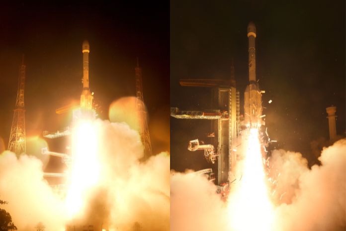
In a major boost to India’s space and security capabilities, the Indian Space Research Organisation (ISRO) has successfully launched the GSLV-F17 rocket carrying the EOS-05 satellite. The mission lifted off at 2:55 am IST on 4 September 2026 from the Satish Dhawan Space Centre at Sriharikota, Andhra Pradesh.
About 18 minutes after launch, the 2,367-kg EOS-05 (also called GISAT-1A) was precisely placed into a Sub-Geosynchronous Transfer Orbit. ISRO Chairman V. Narayanan described the flight as a “great achievement for India” and confirmed that the satellite is in “perfect health”.
What is EOS-05?
EOS-05 is India’s first imaging satellite designed to operate from geosynchronous orbit, roughly 36,000 km above the equator. From this very high vantage point, it can continuously watch large parts of the Indian subcontinent and its neighbourhood.
The spacecraft carries two multispectral imagers. One of these cameras offers about 42-metre resolution, making it the highest-resolution imaging payload ever placed in geostationary orbit.
Why this orbit matters
Most Earth-observation satellites fly in lower orbits and pass over the same spot only a few times a day. A geosynchronous satellite, by contrast, stays over roughly the same region as the Earth rotates. This allows EOS-05 to take repeated images of the same area at short intervals.
Reports indicate that EOS-05 can image the broader subcontinent about every 30 minutes, and revisit priority targets roughly every five minutes. That trade-off—slightly coarser resolution for much faster revisit—is ideal for tracking fast-changing events.
How India will use EOS-05
EOS-05 is a dual-use satellite, meant for both civilian and strategic applications. Its persistent “eye in the sky” is expected to support:
- Disaster monitoring: Near-real-time tracking of cyclones, thunderstorms, floods, landslides and forest fires to improve early warnings and relief planning.
- Weather and environment: Continuous observation of cloud systems, severe weather, and environmental changes over land and ocean.
- Agriculture and resources: Monitoring crop stress, land-use changes, water resources and other parameters important for planning and policy.
- Border and strategic surveillance: Persistent coverage of remote border areas, including the India–Pakistan and India–China frontiers, as well as key strategic assets and conflict zones.
By linking frequent space imagery with national disaster-management systems, EOS-05 strengthens India’s ability to respond quickly to natural hazards and security challenges.
GSLV-F17: A key launch vehicle
The GSLV-F17 is the 19th flight of India’s Geosynchronous Satellite Launch Vehicle (GSLV) series. The three-stage rocket, about 51.7 metres tall, used a 4-metre ogive payload fairing for this mission.
Key mission events included separation of the strap-on boosters and core stage, followed by payload fairing jettison at around 234 seconds and an altitude of about 116 km. At roughly 18 minutes 40 seconds into flight, EOS-05 separated from the upper stage in its targeted Sub-GTO.
From this elliptical orbit, the satellite will use its own propulsion system to raise and circularise its path into a final geosynchronous orbit near 36,000 km.
Why this mission matters
The success of GSLV-F17/EOS-05 reinforces confidence in India’s heavy-lift launch capability after earlier setbacks. It also marks a strategic leap in Earth observation, giving India a persistent, high-altitude imaging capability that only a few countries possess.
With EOS-05 operational, India now has a powerful new tool to monitor disasters, support agriculture and resource management, and keep a continuous watch on its borders from space.